Mapping the Mediterranean
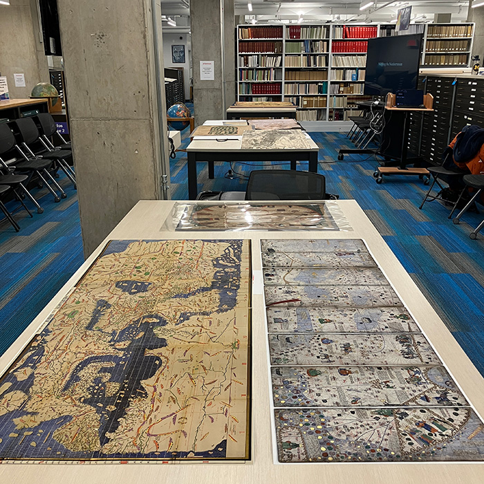
Northwestern undergraduate students in my “ Art and Architecture of the Medieval Mediterranean World” course (ART_HIST 329) visited the Map/Geographic Information Room at the University Library this past winter. My students examined various medieval and early modern maps while learning about the geographies of the Mediterranean. Prior to this hands-on session, Northwestern Library’s Geospatial and Cartographic Specialist, Mech Frazier, gave a guest lecture about geospatial analysis and ArcGIS StoryMaps in digital humanities.
Bihter Esener
Assistant Professor of Islamic Art and Medieval Mediterranean
I am an art historian of the visual and material cultures of the medieval Islamic world, with a special interest in Armenian, Byzantine, and Persian-Islamic artistic exchange and cultural encounters in medieval Anatolia, the South Caucasus, and the Eastern Mediterranean. I teach Islamic art and medieval Mediterranean in the Department of Art History at Northwestern University. My research interests encompass the collection and display of Islamic art in the modern period, sports history, environmental studies, digital art history, and historical game studies.